
8.2 Stream Types
Stream channels can be straight or curved, deep and slow, or rapid and choked with coarse sediments. The cycle of erosion has some influence on the nature of a stream, but there are several other factors that are important including gradient, discharge, and sediment load. A few key types of streams are described below.

Youthful streams that are actively down-cutting their channels tend to be relatively straight and are typically ungraded (meaning that rapids and falls are common). They also have steep gradients and steep and narrow V-shaped valleys—in some cases steep enough to be called canyons.
In mountainous terrain, such as that in western Alberta and B.C., steep youthful streams typically flow into wide and relatively low-gradient U-shaped glaciated valleys. The youthful streams have high sediment loads, and when they flow into the lower-gradient glacial valleys where the velocity isn’t high enough to carry all of the sediment braided patterns develop, characterized by a series of narrow channels separated by gravel bars.
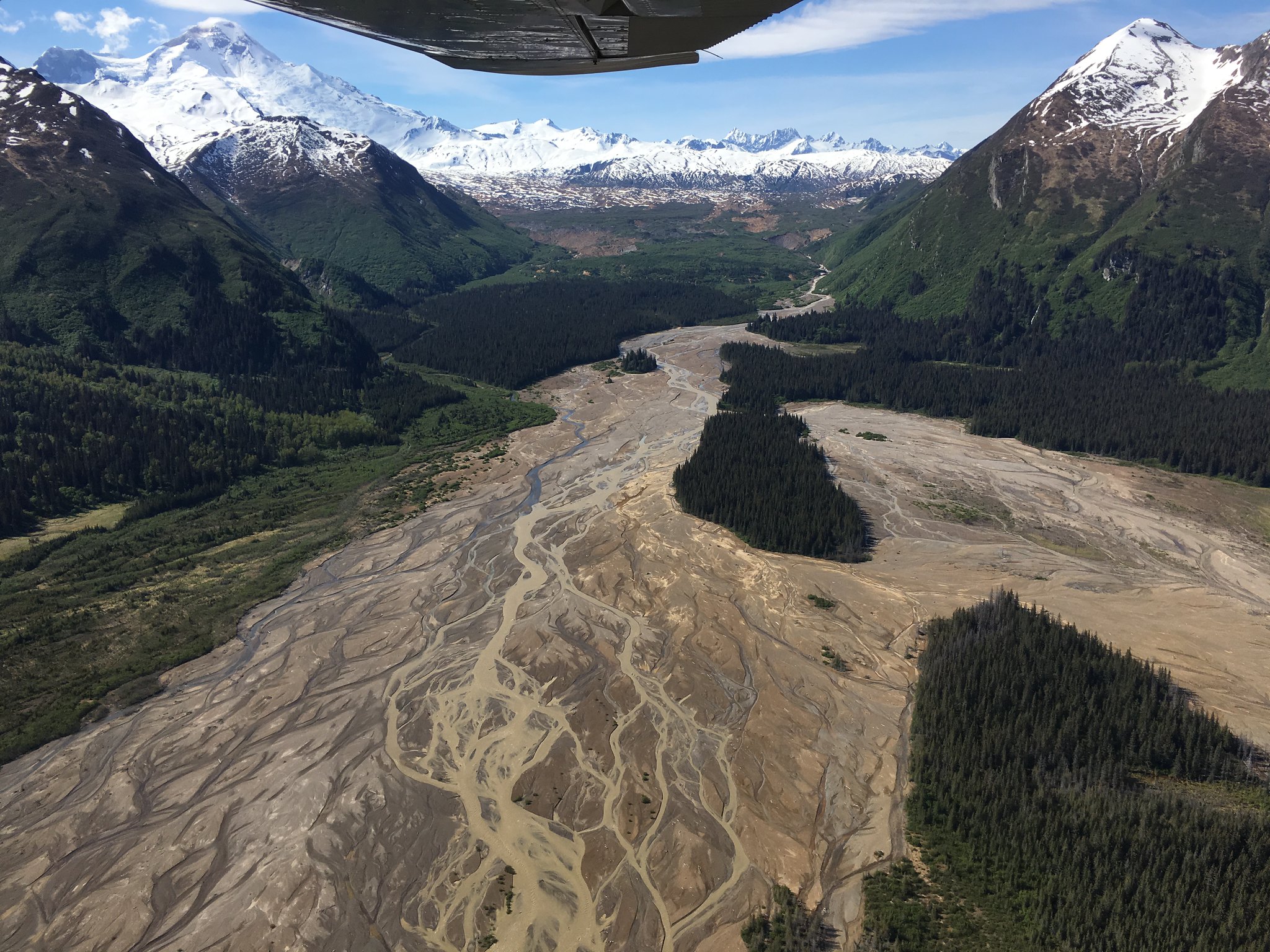
Braided streams can develop anywhere there is more sediment than a stream is able to transport. One such environment is in mountainous areas, where streams carry glaciofluvial sediments from alpine glaciers (Figure 8.2.2). Another such environment is in volcanic regions, where explosive eruptions produce large amounts of unconsolidated material that gets washed into streams. Streams in the volcanic Mt. Meager area of southwestern British Columbia are good examples of this.
A meandering stream that occupies a wide, flat flood plain with a low gradient typically carries only sand-sized and finer sediments and develops a sinuous flow pattern. As you saw in Figure 8.1.1, when a stream flows around a corner, the water on the outside has farther to go and tends to flow faster. This leads to erosion of the cut banks on the outside of the curve, deposition on the inside, and formation of a point bar (Figure 8.2.3). Over time, the sinuosity of the stream becomes increasingly exaggerated, and the channel migrates around within its flood plain, forming a meandering pattern. As point bars develop over time, their surfaces form ridges called scroll bars. There is even evidence of these scroll bars and meandering channels on Mars (Figure 8.2.4)!
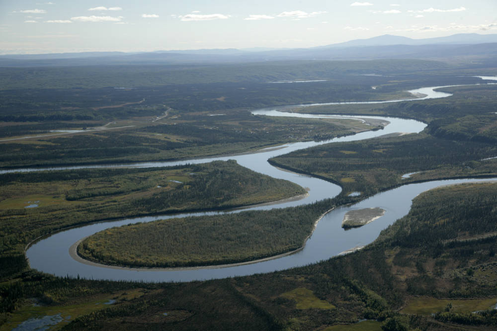
A well-developed meandering river is shown in Figure 8.2.3. The meander in the middle of the photo has reached the point where the thin neck of land between two parts of the channel is about to be eroded through. When this happens, an oxbow lake will form. When an oxbow lake dries up, it leaves behind a curved meander scar filled with muddy sediment.
At the point where a stream enters a still body of water—a lake or the ocean—sediment is deposited and a delta forms. The Fraser River has created a large delta, which extends out into the Strait of Georgia (Figure 8.2.5). Much of the Fraser delta is very young in geological terms. Shortly after the end of the last glaciation (10,000 years ago), the delta did not extend past New Westminster. Since that time, all of the land that makes up Richmond, Delta, and parts of New Westminster and south Surrey has formed from sediment from the Fraser River.
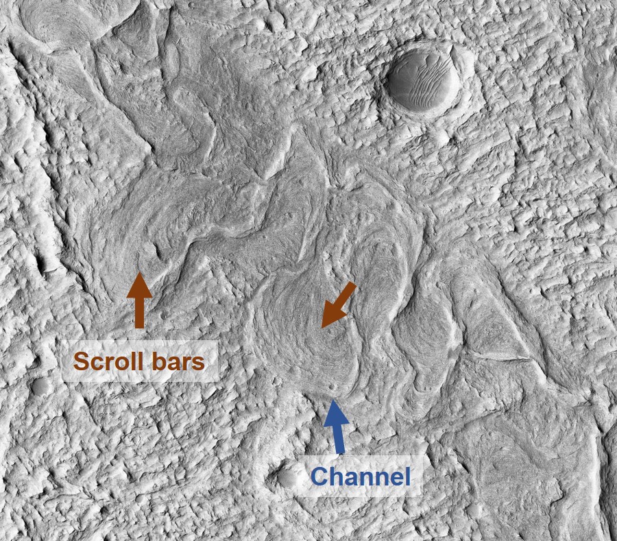
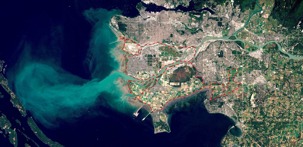
Image Descriptions
Figure 8.2.3 image description: A part of the Alatna River near its confluence with the Koyukuk River has curved around so sharply that it almost forms a circle before curving the other way again. Eventually, as the barrier between these two parts of the channel erodes, they will be joined and form an oxbow lake. [Return to Figure 8.2.3]
Media Attributions
- Figure 8.2.1: © Steven Earle. CC BY.
- Figure 8.2.2: Braided Rivers Lake Clark National Park by K. Lewandowski (NPS). Taken June 2017. Public domain.
- Figure 8.2.3: Alatna and Koyukuk River confluence near Allakaket by Steve Hillebrand (USFWS). Taken August 2006. Public domain.
- Figure 8.2.4: Yardangs and Ridges of the Edge of Aeolis Planum by NASA/JPL/University of Arizona. Taken December 2007. Public domain.
- Figure 8.2.5: Delta of the Fraser River by NASA. Taken September 2011. Adapted by Steven Earle. Public domain.
a stream that is actively down-cutting its valley in an area that has recently been uplifted
a stream pattern which is characterized by abundant sediment and numerous intertwining channels around bars
referring to sediments deposited from a stream that is derived from a glacier
the sinuous path taken by a stream within a wide flat flood plain
a low-lying area adjacent to a river, formed mainly of river sediments and subject to flooding.
A steep stream bank on the outside of a meander formed by erosion.
Formed on the inside of a meander, where flow velocity is lower, by the deposition of sediment.
Curved ridges on the flood plain surface associated with the growth of a meander bend. Formed by sediment deposited on point bars.
a part of a stream meander that has become isolated from the rest of the stream as the result of a meander cutoff
a mud-filled curved scar on the flood plain that marks the former location of an oxbow lake.
