
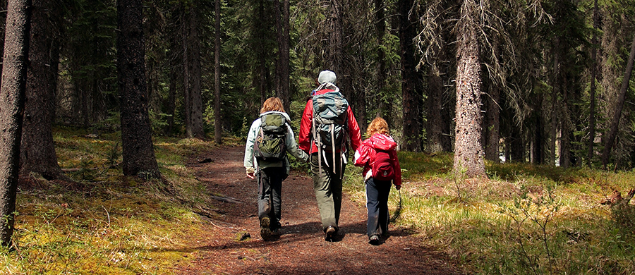
Protected Areas
Canada’s network of parks was built incrementally over the past century. Currently, 12.6% of Canada’s terrestrial land base and 9.1% of its marine environment are protected, though not all ecosystem types are equally represented (Fig. 8.1; ECCC 2022). Approximately 35% of the terrestrial parks are under federal jurisdiction, and the rest are managed by provincial and territorial governments or are privately owned. There are several thousand individual parks, but the one hundred largest account for 72% of the total area (ECCC 2022). Two-thirds of the parks are less than 2 km2.
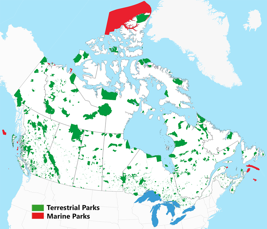
As recounted in Chapter 2, early efforts at establishing parks were ad hoc and emphasized scenic areas. Since then, systematic planning at the regional and national scales has become more common (Andrew et al. 2014). Federal government efforts have been guided by a long-range national park plan (PC 1997). Provincial and territorial efforts have been more episodic, reflecting waxing and waning political interest, with much variability among jurisdictions (Fig. 8.2).

Many different forms of protection exist, including national and provincial parks, migratory bird sanctuaries, national wildlife areas, wilderness areas, conservation areas, ecological reserves, and other designations specific to individual provinces. These different types of protected areas are associated with different priorities and mandates. In addition to their role in maintaining biodiversity, protected areas serve as ecological benchmarks, support recreation, preserve wilderness, and provide laboratories for research into natural processes (Wiersma 2005).
In this chapter, we will focus on sites where the protection of biodiversity is the primary purpose and industrial activities are specifically prohibited. We will refer to these sites as “protected areas” or “reserves,” and we will use the term “park” when referring to more generic forms of protection.
Theoretical Foundations
Protected areas have long been a cornerstone of biodiversity conservation. Whereas conservation on the working landscape is characterized by compromise with competing land-use objectives, biodiversity comes first within protected areas. Moreover, there is no uncertainty about whether prescribed protection measures will be implemented or work as intended, given that industrial use is prohibited. The certainty that protected areas provide explains their appeal as a conservation tool. The main limitation of protected areas is that it is rarely possible to set aside enough of the landscape to ensure adequate protection for all species. Therefore, conservation efforts on the working landscape remain vital for maintaining biodiversity, complementing the protection provided by reserves.
Our discussion will focus on reserve design and reserve management. Reserve design remains an important topic because gaps exist in the current network (Andrew et al. 2014). Some regions are underrepresented (Fig. 8.1), and the overall amount of protection falls short of the targets that Canada has committed to. As with the previous two chapters, we will focus on conventional practices and defer discussion of climate change issues to Chapter 9.
Box 8.1. IUCN Protected Area Categories
The IUCN has defined six categories of protected areas. These categories are widely referenced in conservation planning applications (Dudley 2008).
I. Strict nature reserve or wilderness area. Sites where human use is strictly controlled to ensure the protection of natural conditions and biodiversity.
II. National park. Large natural areas that are set aside to protect large-scale ecological processes along with the characteristic biotic components.
III. Natural feature or monument. Generally small sites that protect a specific feature, such as a unique landform or biological community.
IV. Habitat/species management area. Sites that aim to protect particular species or habitats, with management that supports this priority.
V. Protected landscape or seascape. Sites with distinct characteristics that arise from the interaction between people and nature over time.
VI. Protected area with sustainable use of natural resources. Generally large, mostly natural sites where a proportion is under sustainable natural resource management and where low-level, non-industrial resource use is a management objective.
Modern concepts of reserve design trace back to seminal research in the 1960s and 1970s on reserve size and species representation. Biologists working with island ecosystems observed that large islands tended to have more species than small islands. The field of island biogeography was developed to explain these findings and to quantify the relationship between island size and species richness (MacArthur and Wilson 1967).
The findings of island biogeography were later extended to reserve design by treating protected areas as islands of natural habitat in a sea of anthropogenic change (Diamond 1975). This gave rise to the general principle that large reserves are preferable to small reserves because they can sustain more species. However, conservation scientists also noted a trade-off. When the amount of land available for protection is limited, a large reserve is not as effective as multiple small reserves in representing all habitat types (Fig. 8.3). This led to a prolonged debate over design priorities, commonly referred to as the “Single Large or Several Small” (SLOSS) debate (Simberloff and Abele 1982).
 |
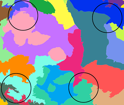 |
| Fig. 8.3. The SLOSS debate centred on the relative merits of a single large reserve (left map) versus several small reserves (right map). Smaller reserves are better able to achieve representation of all habitat types, which can be seen in this overlay of ecodistricts from the National Ecological Framework. However, a single large reserve is more likely to maintain ecological function and retain all ecosystem components. The total area of protection is the same in both maps. | |
The SLOSS debate was never fully resolved because there is no definitive answer as to which design feature is most important. Size and representation both need to be considered, along with several additional factors. In current practice, the optimal reserve configuration is determined on a case-by-case basis, facilitated by a structured decision-making process. There are two distinct questions that need to be answered. First, how much of the landscape should be protected? Second, what is the optimal spatial configuration of the reserves? We will examine each question in turn.
